|
Neatsville
|
|
|---|---|
|
Unincorporated community
|
|

Neatsville
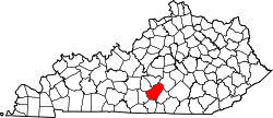
Location within the state of Kentucky

Neatsville
Neatsville (the United States)
|
|
| Coordinates: 37°11′50″N 85°7′32″W / 37.19722°N 85.12556°W | |
| Country | United States |
| State | Kentucky |
| County | Adair |
| Elevation | 705 ft (215 m) |
| Time zone | UTC-6 (Central (CST)) |
| • Summer (DST) | UTC-5 (CDT) |
| ZIP code |
42728
|
| GNIS feature ID | 508677 |
Neatsville is an unincorporated community in Adair County, in the U.S. state of Kentucky. It is located at the junction of Kentucky Route 206 and Kentucky Route 76.[1][2] Its elevation is 705 feet (215 m).[3] For unknown reasons, the town's name was spelled as Neetsville from 1876 until 1886, when the town's post office closed.[3][4] In its early history from around the 1810s to 1900, Neatsville progressively grew to become a well-established, incorporated town. It has been relocated twice through the years, once due to flooding c. 1900 – c. 1902, which decimated the town, and once in the 1960s when the Green River was impounded to make way for the Green River Reservoir State Park.
Geography
Located in the north-east of Adair County, nearby communities are Eunice in the south, Pellyton in the north-east and Dunbar Hill in the north west.[2]
History
Various sources and accounts have referred to Neatsville as a village, as a postal village, as a hamlet, and as a town at different times in its history.[4][a][6][7]
The community was settled in the early 1800s by the Neat family, with Randolph Neat being the first to acquire land there.[2][4] As it expanded, the community grew to encompass several stores, a hotel, a doctor's office, mills, a sawmill, distilleries, a saloon, a salt works, a cooper shop, a carding machine, and a Masonic Lodge.[2][6][b][7][9][10]
It was incorporated as a town on February 23, 1847.[6] Its post office was established on March 13, 1844, and closed in 1886.[4] In 1848 the town's population was estimated to be around 50, and in 1876 the town's population was estimated at 60.[11][12] The Masonic Lodge was relocated to Pellyton in 1917.[6]
Relocations
Sometime between 1901 and 1902, a significant flood devastated the town, necessitating its relocation from the north bank to the south bank of the Green River. At that time, the former location was abandoned.[4][6][9] Erosion had occurred in the foundations of the buildings in the former location due to the flooding.[9]A 1916 local account of the town's former site after the flooding characterized it as "nearly obliterated" and "in ruins".[10]
Neatsville was later relocated to its present location sometime in the 1960s, when the Green River was impounded to enable the creation of the Green River Reservoir.[4]
Notes
References
- ^ TOPOZONE-Neatsville Topo Map in Adair County KY
- ^ a b c d Allison, V.R. (1972). Methodist History of Adair County Kentucky: 1782-1969. Monroe County Press. p. 355. Retrieved September 22, 2018.
- ^ a b U.S. Geological Survey Geographic Names Information System: Neatsville, Kentucky
- ^ a b c d e f Rennick, R.M. (2013). Kentucky Place Names. University Press of Kentucky. p. 373. ISBN 978-0-8131-4401-6. Retrieved September 22, 2018.
- ^ Dunkle, G.M.K.; Greenwald, M.W. (1997). Diary of George McKinney Dunkle: August 25, 1862 to November 29, 1864: 112th Regiment Illinois Volunteers, Company D. M.T. Pub. p. 42. Retrieved September 22, 2018.
- ^ a b c d e Grant, Susie (March 2, 2014). "Neatsville: Once bustling town was incorporated for a time". Columbia Magazine. Retrieved September 22, 2018.
- ^ a b Baldwin, T.; Thomas, J. (1854). A New and Complete Gazetteer of the United States: Giving a Full and Comprehensive Review of the Present Condition, Industry, and Resources of the American Confederacy ... 19th-century legal treatises. Lippincott, Grambo & Company. p. 763. Retrieved September 22, 2018.
- ^ Kentucky. General Assembly. Senate (1867). Journal of the Senate of the Commonwealth of Kentucky. p. 151. Retrieved September 22, 2018.
- ^ a b c Patton, P.W. (1990). A History of the Christian Churches in Adair County, Kentucky. P.W. Patton. p. 102. Retrieved September 22, 2018.
- ^ a b "Local Adair Co., KY history: Neatsville remembered". Columbia Magazine. October 18, 2010. Retrieved September 22, 2018.
- ^ Collins, L. (1848). Historical Sketches of Kentucky. L. Collins. p. 165. Retrieved September 22, 2018.
- ^ R.L. Polk & Co (1876). Kentucky State Gazetteer and Business Directory. R.L. Polk & Company. p. 409. Retrieved September 22, 2018.
|
Municipalities and communities of Adair County, Kentucky, United States
|
||
|---|---|---|
|
County seat: Columbia
|
||
| City |
|
|
| Unincorporated communities |
|
|
| Footnotes |
‡This populated place also has portions in an adjacent county or counties.
|
|
|
||